Health & Fitness
Back to Reality This Week
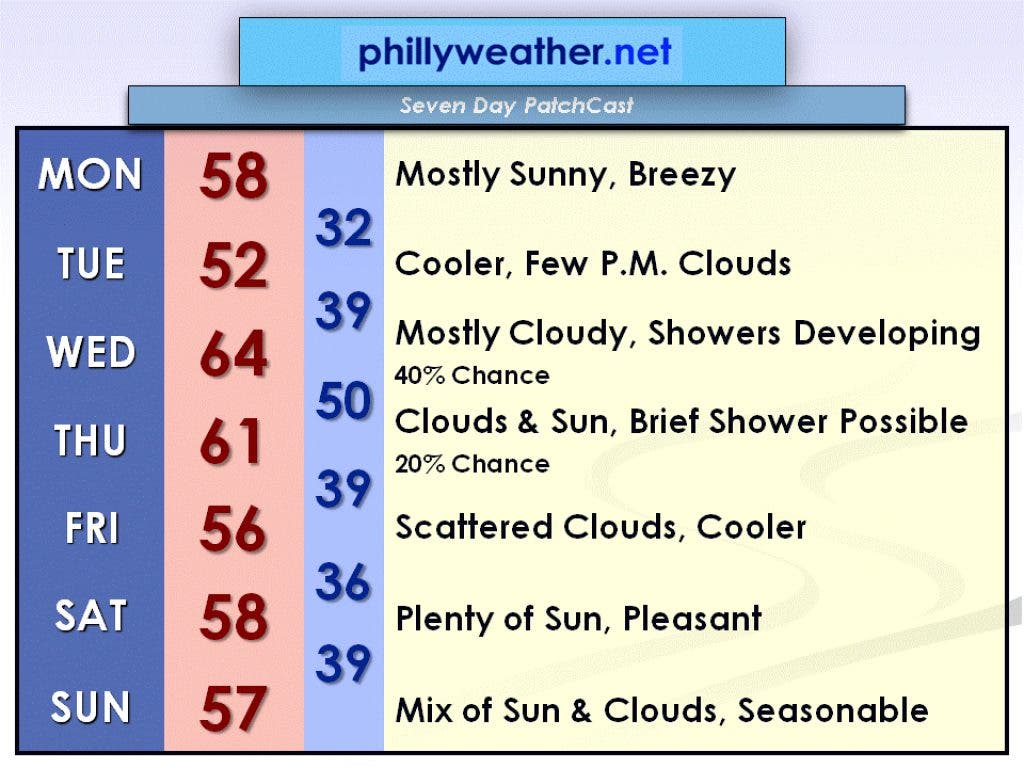
Temperatures will still be slightly above average this week, but it will be feeling more like March.
Although most of last week was warm, only one record high was broken at Philadelphia International Airport. This occurred on Friday when the airport recorded a high of 80 degrees at 3:16 p.m. The old record was 78 degrees, set back in 1938 and 1907.
The normal high for this time of year is 56 degrees, and the normal low is 37 degrees. We will be much closer to these typical March temperatures this week, and although most of the week will still be slightly above average temperature-wise, it will probably feel cool outside for most people since we were spoiled with summer-like temperatures last week.
A high sitting on the southern shores of the Hudson Bay and a low sitting off the east coast of Nova Scotia will interact today and create gusty winds for the Delaware Valley due to the sharp change in pressure between these two systems. North winds will be gusting near 35 mph through most of the day. The high temperature should make it into the upper 50s. High pressure will move eastward on Tuesday but will circulate some cooler air down from Canada. An approaching low from the west could spawn a few afternoon clouds, but otherwise bright sun is expected with a high temperature in the lower 50s.
Find out what's happening in Collingswoodwith free, real-time updates from Patch.
The low-pressure system moves into the area on Wednesday and brings with it some showers. The day shouldn't be a wash out as showers should be scattered in nature, but you may want to pack the umbrella as you head out the door to work or school. Wednesday will be mild, however, with a high temperature in the mid-60s. Thursday should still feature temperatures in the 60s, but there is a slight chance of a brief shower as the low-pressure system departs.
High pressure builds back in for Friday, bringing down some more cooler air from Canada and high temperatures will hold in the mid-50s. High pressure remains in place for the weekend, featuring seasonable temperatures in the upper 50s with sun and a few clouds.
Find out what's happening in Collingswoodwith free, real-time updates from Patch.
Feel free to check in with Phillyweather.net throughout the week for updates with Wednesday and Thursday's rain chances!